Border is the line that separates from one country to another, state or province, although many boundaries or border that divide one country to the other, is just a foot ahead. You can cross the border by foot, but still policies from Immigration of each country are strictly followed. And without the proper visa required, you can be denied in your entry. For instance, the Denmark border between Sweden and Norway is known as “border by sea” and the boundaries between Canada and Denmark is between Greenland and Baffin Island and France, bordered by St Pierre Island and Newfoundland Island. Other borders are partially or fully controlled, and may be crossed legally only at designated checkpoints in every border. Some, mostly contested and causes arguments between border officers and visitors crossing borders, there are borders that set up by buffer zones or a zonal area between two or more countries, to segregate the regions or conjoin them, and the most common buffer zones are demilitarized zone (DMZ, is an area or border between two or more military alliances or powers), border zones ( borders of states that have restrictions for exit and entry point commonly monitored by border patrol and immigration and custom officials. Immigration authorities usually place stamps in passports at a port of entry or border crossing, as part of their immigration control or customs procedures.
1) Canada and United States Border
Entering Canada at Peace Arch (border between United Sates and Canada)

peace arch on the border of USA and Canada this arch has two
Canada -United States border building
Niagara Falls Bridge- Border Canada to United States
From the Canadian side, any nationality have to pay $50 for crossing the border bridge of Niagara Falls entering US territory, as the US citizen do not need to pay.
United States and Mexico Border
San Ysidro Border Crossing, California-Mexico Border, Baja California

Walking across the border from San Ysidro, California to Tijuana, Mexico

US authorities closed the world’s busiest land border crossing for several hours after a shootout between suspected Mexican human traffickers and US agents,
The United States – Mexico border is border between the United States and Mexico, with total length is 3,169 km (1,969 miles), measured via the International Boundary and Water Commission and the most crossed border frequently in the world, with more or less three hundred fifty million crossings per year. People from San Diego, California, and Tijuana, Baja California, in the west to Matamoros, Tamaulipas, and Brownsville, Texas, in the east, and traverses a variety of terrains, ranging from major urban areas to dry and hot deserts. From the Gulf of Mexico it follows the course of the Rio Grande (Río Bravo del Norte) to the border crossing at El Paso, Texas, and Ciudad Juárez, Chihuahua; westward from that urban agglomeration it crosses vast tracts of the Sonoran and Chihuahuan Desert, the Colorado River Delta, westward to the urban agglomeration of San Diego and Tijuana before reaching the Pacific Ocean.
United States-Mexico Border

US and Mexico Border
2) Denmark and Germany with 68 km Border Length
Øresund Bridge combined twin-track railway and dual carriageway bridge-tunnel across the Øresund strait between Sweden and Denmark
Stockholm, Sweden
Danmark

Germany-Denmark border (Tonder, Danmark)
Border crossing between Germany and Denmark
Denmark and Sweden are connected via the longest bridge known as Oresund Bridge, and the border around the area of Hans Island, between Canada and a Danish dependent territory known as Greenland which still debated and undefined solution.
3) Dominican Republic and Haiti 360 km Border Length
Haitians cross the border with the Dominican Republic in the municipality of Jimani
Haiti and Dominican Republic Border
The Dominican Republic negotiated finally with the undisputed Haiti border , and in early May, floods had killed over 3,000 people on Haiti‘s southern border with the Dominican Republic. There has been little marine, coastal, and river. Haiti is the neighboring nation to the Dominican Republic and was its former ruler. And Haitians estimated to hundreds of thousands have migrated to the Dominican Republic,while others put the Haitian-born population as high as one million.They usually work at low-paying and unskilled jobs in building construction, household cleaning, and in sugar plantations. There have been accusations that some Haitian immigrants work in slavery-like conditions and are severely exploited.
Haitian’s children of illegal Haitian immigrants are often denied and have stateless services, as their parents are denied Dominican nationality, being deemed transient residents due to their illegal or undocumented status, the children, though often eligible for Haitian nationality, are denied it by Haiti because of a lack of proper documents or witnesses. The major island in the Caribbean is the Hispaniola, and have the two sovereign states of Haiti and the Dominican Republic. This island is within the hurricane line, located between the islands to the east of Puerto Rico and Cuba to west.
4) Gambia and Senegal 740 km Border Length
Border Gambia-Senegal
Senegal – Gambia border

Senegal Border
The Republic of Gambia bordered by north, south and east Senegal. The Gambia is a very small and narrow country whose borders mirror the meandering Gambia River. The northern border is formed by the Senegal River, and The tiny border post crossing north of Velingara from Senegal to Gambia.
Lesotho and South Africa 909 km Border Length

Lesotho and South Africa Border
Maseru Border Gate – Lesotho

Mmabatho on South Africa border with Botswana
Lesotho in political geographical term, an enclave is a territory whose geographical boundaries are entirely surrounded by the boundaries of another territory. An exclave, on the other hand, is a territory legally or politically attached to another territory with which it is not physically contiguous and entirely surrounded by South Africa. Maseru is located in northwest Lesotho by the South African border, The river forms part of the international borders between South Africa and Namibia and between South Africa and Lesotho,
5) Ireland and United Kingdom 360 km Border Length
Ireland and United Kingdom Border

Northern Ireland Railways Revitalisation, United Kingdom Doubling jointly operated cross-border
The border between the British Overseas Territory of Gibraltar and Spain
The United Kingdom borders the Republic of Ireland, and also connecting France via the Channel Tunnel. The sovereign base of the UK sovereign base areas, sharing borders of Akrotiri and Dhekelia with Cyprus. The UK overseas territory of Gibraltar shares border with Spain.
6) Monaco and France 4.4 km Border Length
An anti-G20 demonstrator at the France-Monaco border

France and Monaco Border
Monaco is surrounded on three sides by France, the last Mediterranean border. The modern France border are almost the same as those of ancient Gaul, which connecting with Belgium’s neighboring cities in Spain, Andorra, and the sovereign city of Monaco, located on the French Riviera in Western Europe and bordered by France and its center is about 16 km from Italy, and north east of Nice, France which is only 15km. It has an area of 1.98 km2 , and a population of 35,986, making Monaco the most populated and the second smallest country in the world. Monaco levies no individuals income tax, and this absence of a personal income tax, attracted to it a considerable number of wealthy “tax refugee” residents from European like famous celebrities, for example the Formula One drivers, countries who derive the majority of their income from activity outside Monaco, but the majority of them are not well-known business people.This applies to all residents of Monaco of any nationality except French citizens whose residency started after 1957. These French citizens still must pay French income tax.
Belgium and France Border
Belgium and France Border
Moselle River at the tri border of France ,Luxembourg and Germany
7) Portugal and Spain 1,214 km Border Length

Portugal/Spain on Barca d’Alva – Border Crossings

Spain/Portugal border west of Sevilla

Portugal and Spain Border
Spain and France Border Crossing
Spain On the west, Spain borders Portugal; on the south, it borders Gibraltar (a British overseas territory) and Morocco, through its exclaves in North Africa . Portugal The land within the borders of the current Portuguese Republic has been … platform, which are joint research programs of both Portugal and Spain.
8) San Marino and Italy 39 km Border Length
Italy – San Marino main border crossing in the town of Dogana
Pedestrian bridge marking the Italy-San Marino border

Italy and San Marino Border
San Marino is an enclave in Italy, on the border between the regioni of Emilia Romagna and Marche and about 10 km (6.21 mi) from the Adriatic coast at Rimini.
Italy and Vatican City 3.2 km Border Length
Border crossing between Italy and Vatican City State
border from Rome to Vatican City
Italy To the north, it borders France, Switzerland, Austria and Slovenia … The independent states of San Marino and the Vatican City are enclaves within Italy, The military defense of the Vatican City is provided by Italy and its armed forces, given the fact that Vatican City is an enclave within the Italian Republic.
9) South Korea and North Korea 238 km Border Length

South Korea and North Korea Border, The Panjumon DMZ
North Korea border, the most scariest border in the world
The DMZ Joint Security Area, where the soldiers as the border patrols of South Korea and North Korea, across the military demarcation line of each side, the exercising power between two countries. This border between the South and North Korea, is the low stripped concrete, behind which the North Korean soldiers stand in formation with dark uniforms, and lighter uniforms for the American and South Korean soldiers. In this picture the tall building at the back ground is the North Korean border post, and considered this border as the most weird and scary border in the world.

border between north and south Korea
South Korean soldiers passed cargo trucks lined up to enter North Korea at the customs, immigration and quarantine office in Paju, South Korea, near the border village of Panmunjom, on Tuesday.
The Panmunjom village is the border and the Demilitarized Zone of the North and South Korea and demarcation line dividing these two countries.
Jilin Province, China Border and North Korea Border
Friendship Bridge, China/North Korea border, Jilin Province.
North Korean soldiers carrying the North Korean flag and shovels march Monday along a fenced border near the Chinese city of Dandong.
China and North Korea border
10) Papua New Guinea and Indonesia 820 km Border Length
Papua New Guinea and Indonesia Border, by land crossing borders
Indonesia -Papua New Guinea Border
Visa matters
Although Indonesia gives visas on arrival to some nationalities, you will still be needing an arranged visa for crossing the border of Indonesia and Papua New Guinea. The Indonesian Consulate is located in Vanimo, also known as the Embassy of Port Moresby, where one nationality can apply for their visa or extension of visa purposes and pay for the visa processing fee is required.
Getting to the border- the paved road has two lanes, but car is not allowed to get inside, so you must take a ride from a Vanimo bound vehicles to get to the border and the Immigration office, then another ride going to Jayapura, where the public buses (PMVs) depart regularly for the border which the travel is about 45 minutes, or you can ask any from the town folks for some added information. You can hitchhike for the outgoing road from the town at an early hour in the morning.
Crossing into Indonesia.
In Indonesia, it is a five minutes walk from the border going to the Immigration building, where you must fill up the arrival and departure card which you must carry all throughout your stay in the country until your departure time and back from the country of your origin. Some border guards ask for some “extra fee”, usually for cigarette or snack money, just be polite and ‘ask’ for official receipt, and they usually turn it down.
To Jayapura: There many chartered taxis waiting at the border, no matter how many passengers the taxi will have, it will still cost you 400,000 rupiyah. There are buses which is more cheaper, but you can not count on it, or may be you will just feel uncomfortable with the buses. If you want to pay more cheaper taxi fare, then jus wait for more passngers to cross the border and you can divide it with other passengers.
Timor-Leste and Indonesia 228 km Border Length
Timor-Leste Border Immigration (former East Timor) – Indonesia border
Indonesia Grenze Border to Timor-Leste
11) Singapore and Malaysia
Singapore border to CIQ – Customs, Immigration & Quarantine Complex, Johor Bahru
drive from Singapore cross the border to Johor Bahru and Malaysia
Singapore, although an island nation with no natural land borders, is connected to Malaysia via the Johor Bahru Causeway and the Malaysia- Singapore Second Link. From Singapore crossing the border to Malaysia, you can take the train or bus to Johor Bahru Causeway Immigration border.
Singapore and Indonesia
Singapore Ferry Terminal bound for Batam or Bintan, Indonesia Border
Ferry Boat at the Singapore Ferry Terminal bound for Bintan Indonesia
Indonesia Ferry Terminal and Immigration /Custom Office from Singapore
12) Malaysia and Thailand
Malaysia-Thailand Immigration Border

Komplex Imigresen Rantau Panjang

Welcome in Sungai Golok Thailand border -Malaysia
The Thailand and Malaysia legal land border crossings where one traveler needs a visa stamped by Immigration authorities that allows any nationality of non-resident of Malaysia or Thailand, and also for Malaysian nationals entering the border of Thailand or vice versa. These borders are the following so you will know which border you should enter: If you go to Sadao border in Thailand (now in Dannok) entering Changloon, Malaysia border, or the Padang Besar Thailand border o Kaki Bukit Malaysia border, Betong Thailand border to Keroh Malaysia border and Sungai Golok Thailand to Rantau Panjang Malaysia. The to the south border of Thailand and Malaysia, to the Northeast Laos border, and Cambodia to the east and west is the Myanmar border. The borders crossings between Malaysia and Thailand; Kelantan Malaysia, Pengkalan Kubor to Narathiwat Tak Bai Thailand, Kelantan Rantau Panjang Malaysia, to Narathiwat Sungai Kolok Thailand, Kelantan Bukit Bunga Malaysia to Narathiwat Buketa Thailand, Kedah Bukit Kau Hitam Malaysia border to Songkhla Sadao Thailand border, Perlis Padang Besar Malaysia to Songkhla Padang Besar Thailand border, Kedah Durian Brung Malaysia to Songkhla Ban Prakob Thailand border, Perlis Wang Kelian Malaysia to Satun Wang Prachan Thailand border, and Kedah Langkawi Island Malaysia to Satun Thammalang Thailand border.
13) Thailand – Laos Border

Thailand – Laos Border and Immigration Office
Ferry boats Crossing frm Chiang Khong,Thailand to Laos border,

Thailand border town for entry to Laos. – Chiang Khong, Thailand …
14) Brunei and Malaysia 381 km Border Length

From PER to Brunei and across the border to Malaysia and back
Malaysia-Brunei Border
Kota Kinabalu, Malaysia to Brunei Darussalam in 1 day get to Jesselton Point ferry terminal
Borders the Malaysian state of Sarawak on the island of Borneo.
Kota Kinabalu, Malaysia Ferry Terminal to Brunei Darrusalam
Kota Kinabalu, Malaysia Ferry Boat Station for Brunei Darussalam
Brunei Ferry Boat Terminal from Malaysia
Kota Kinabalu City Bus Terminal , Malaysia – Brunei, 7 hours travel
15) Malaysia and Philippines

Ferry boat from Zamboanga city, Philippines to Sabah, Malaysia

Zamboanga City, Philippines to Sendakan, Malaysia Border
16) Hong Kong and Shenzhen, China
Hong Kong – ,Shenzhen border station, Immigration and Custom Office
Huanggang Border Crossing with Hong Kong” Shenzhen Transportation
Hong Kong Luohu exit station to ShenZhen, China border
Shenzhen border entry from Hong Kong
From Hong Kong, if you go to ShenZhen border, you have to go to the immigration office to acquire a China visa for $200 HKD visa fees, soon you arrived the Lo Wu border station if you go by train, or in Huanggang border if you go by bus.
17) Macau and Hong Kong

Chia Hong Kong City, 33 Cato Road, Tsim Sha Tsui, Kowloon
Hong Kong Ferry Terminal to Macau border

Macau Ferry Terminal and Border Immigration /Custom Area
Macau Ferry Terminal from Hong Kong
In Hong Kong there are two ferry terminal usually used to reach Macau. The first one is Hong Kong China Ferry Terminal at Tsim Sha Tsui in Kowloon area, you can go to this terminal. Beside Ferry Terminal at Tsim Sha Tsui, there also one terminal in Hong Kong Island called Hong Kong Macau Ferry Terminal, the ferry turbo jet and this ferry terminal is located at Sheung Wan. you can ask the taxi to bring you to Central, Northpoint, Admiralty, Wanchai on Hong Kong Island, just go to Sheung Wan Ferry Terminal.
Macau and Zhuhai, China
The Barrier Gate, which was once the portal from Portuguese-owned Macau to the People’s Republic of China. Now it stands at the border of Macau Special Administrative Region Immigration office
It borders the Zhuhai Special Economic Zone in mainland China. The main border crossing between Macau and China is known as the Portas do Cerco (Barrier Gate) on the Macau. Once you enter Macau from Hong Kong, the Immigration authorities will stamp you a 30 days visa , and this is for neighboring Asian countries, for other nationalities you have to check it at the embassy in your country.

Zuhai, China border gate from Macau Portal

Zhuhai border and Foshan, China border
18) Bahrain and Saudi Arabia Border

Dammam, KSA border and Bahrain border
Bahrain and Saudi Arabia border

Bahrain Tower Border landmark and Saudi Arabia border
The island nation known as Bahrain, is connected via the border of King Fahd Causeway, to Saudi Arabia, while Qatar is connected via the border of the Qatar – Bahrain Friendship Bridge but planned but as yet incomplete.

Saudi Arabia border
Saudi Arabia and Kuwait Border
Al Khafji Gate, Saudi Arabia border to Kuwait border
Border crossing between Kuwait and Saudi Arabia
a warning sign in Kuwait border to Iraq Border
19) Abu Dhabi -Dubai -Oman Borders
The border crossing between Dubai and Abu Dhabi.
Road E22 from Abu Dhabi to Al Ain, Dubai
Since the beginning Dubai in early years, was always at odds with Abu Dhabi, since the 1947 dispute between the Dubai and Abu Dhabi border on the northern sector of their mutual border, and intensify the war and the British helped to resolve the disagreement between two or more parties in order to avoid disputes.
20) Mongolia and Russia Border

Russia – Mongolia Border Crossing, 20Hours train ride from Ula Ude, Russia to Ulanbaator Mongolia

Queue in Mongolia border entering Siberia Russia border
The Mongolia and the Russian Federation bilateral relations have been traditionally strong since the Communist era, when Soviet Russia was the closest ally of the Mongolian People’s Republic. Russian embassy is located in Ulaanbaatar in Mongolia and there are two consulate generals in Erdenet and Darkha. While the Mongolian Embassy is located in Moscow, three consulate generals in Ulan Ude, Kyzyl and in Irkutsk and Yekaterinburg branch. Both countries are full members of the Russia is a participating state, while Mongolia is a partner and both countries are Organization for Security and Co-operation in Europe members. Mongolia is sandwiched between the People’s Republic of China to the south and the Russia to the north and its economy, foreign affairs and defense are directly influenced by them. Russia and Mongolia both share a 3,500-kilometer border crossing.
Mongolia and the Republic of China Border
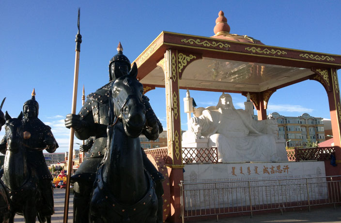
Mongolia and Republic of China border crossing Zamyn-Uud Mongolia Border
China – Mongolia border, Erlian (aka Erlianhaote) Beijing, border
First, you have to stop at the Chinese immigration to get your exit passport stamp with your embarcation card or the arrival and departure card, before you are allowed to enter the Mongolian border entry. For Americans, at least, no visa is required to Mongolia, for some Asians, they will be given the stamp visa, but for other nationality they could check the embassy, or they may be required a visa applied or arranged in their country of origin. Once you are across the Mongolian border of large amount of places to have your currency changed or converted with Mongolian currency at the rates posted, where all cars stop near the train station and central square in Zamyn-Uud. Then you can buy train tickets from here to Ulaanbaatar for UB 16,300 tugrug, about $13 to $14 for hard sleeper, and departing at 17:35 daily at the ticket office which is at the far corner of the square on the second floor of a black, shiny building that is not immediately seen, but approach towards the train tracks and it can be seen.
China and Russia Border

China and Russia Border

boundary marker for eastern section of China and Russia border at Heixiazi

Border crossing between Russia and China
The treaty of the 1991 Sino-Soviet Border Agreement between the Soviet Union and the People’s Republic of China,that set up demarcation work to resolve most of the border disputes between the two states. The People’s Republic of China signed initially and the Soviet Union, the terms of the agreement were resumed by Russia after the breakup of the Soviet Union and this treaty had minor territorial changes result with the borders.
Wagah Border crossing between India and Pakistan along the Radcliffe Line

Wagah Border Lahore, border patrols of Pakistan and India , daily routine of exhibitions

Wagah border Pakistan and India

Wagah Border Ceremony by Border patrol

this is a kind of weird ceremony of border patrols from India and Pakistan
Wagah is the only border crossing between India and Pakistan, located on the Grand Trunk Road between the cities of Amritsar, India and Lahore, Pakistan. This border is also called the Berlin of Asia, and it is a ceremonial border between the Indian and Pakistan border, where every night a ceremony is held called a “retreat ceremony of lowering of the flags”, which started since 1959. During this ceremonies, the B.S.F or Border Security Force of India and Pakistan Rangers soldiers, do some energetic parades with stomping of boots , which in the eyes of visiting foreigners, it looks like and ‘aggressive and hostile’ acts. However, some look at it as weird and funny, imitating the anger and pride of a young rooster. Each country troops are in their uniforms with their colorful turbans while doing the show ceremonies. Sometimes, these BSF of each country, walk over the offices on other sides for their daily affairs, and this has been a barometer of the India and Pakistan relation for the past many years.
Pakistan and Afghanistan Border
Pakistan border posts